|
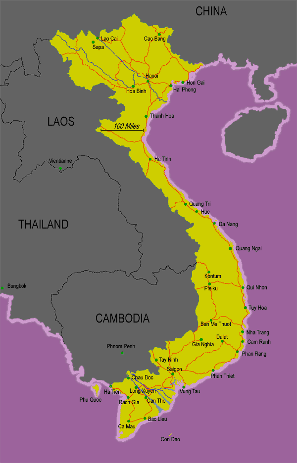
Vietnam
is approximately 331,688 square km. Vietnam extends 1600km from China to
the Gulf of Thailand.
Location
On the East coast of the Indochinese Peninsula in South East Asia
Neighbours
China on North, Laos, Cambodia on West Hills and densely
forested mountains, with level and covering no more
than 20%. Mountains account for 40%, hills 40%, and forests 75%.North
consists of highlands and the Red Rive Delta.
Highest Point Fan
Si Pan; 3143 m (10,312 ft) above sea level South divided into coastal lowlands,
Giai Truong Son with high plateaus, and Mekong River Delta.
Lowest Point Sea
level along the coast
Climate
Vietnam's
extension over several latitudes makes for variable climates between the
three historically divided regions of the country. The weather in North
Vietnam (Bac Bo) is relatively cool, with mild temperatures and little
rainfall during the winter( Nov-April), and heavy summer rains that can
culminate in violent typhoons( May-Oct.). In the humid South (Nam
Bo), constant temperatures average 30C. Here, the dry season starts in
November and ends in April, with two scorching months falling in front
of the wet season (May-Oct). Central Vietnam (Trung Bo) has transitional
weather. Hue, sitting in the middle of Vietnam's coastal curve, tends to
be overcast and rainy most of the year, even in the dry season between
February and April. In the interior highlands of the country, night temperatures
are cool and can be absolutely frigid during the winter (Oct-March). The
"infernal" months of March and April average a pleasant 26C. |